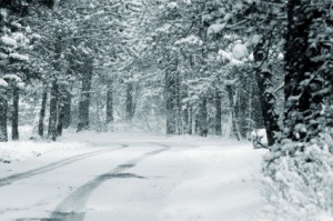
The snow level will certainly change, but we saw it starting to stick on Highway 4 at Forest Meadows at around noon.
We hope you all had a great Christmas.
Conditions in and around Arnold related to storm activity, fires, events, etc.
The snow level will certainly change, but we saw it starting to stick on Highway 4 at Forest Meadows at around noon.
We hope you all had a great Christmas.
If you are headed into the mountains this weekend, please plan for inclement weather and drive carefully.
——————————————————————————————-
URGENT – WINTER WEATHER MESSAGE
NATIONAL WEATHER SERVICE SACRAMENTO CA
341 PM PDT SAT MAR 17 2012
…WINTER STORM WILL BRING SNOW SHOWERS TONIGHT…
.A COLD WINTER STORM WILL LEAD TO SNOW SHOWERS OVER THE WEST SLOPE OF THE NORTHERN SIERRA AND ADJACENT FOOTHILLS TONIGHT. SNOW LEVELS HAVE LOWERED TO NEAR 2500 FEET…AND WILL REMAIN LOW THROUGH THE NIGHT. SNOW LEVELS MAY LOWER FURTHER IN HEAVIER SHOWERS.
CAZ069-181800-
/O.NEW.KSTO.WW.Y.0011.120317T2241Z-120318T1800Z/
WEST SLOPE NORTHERN SIERRA NEVADA – INCLUDING THE CITY OF…BLUE CANYON 341 PM PDT SAT MAR 17 2012
…WINTER WEATHER ADVISORY IN EFFECT UNTIL 11 AM PDT SUNDAY…
THE NATIONAL WEATHER SERVICE IN SACRAMENTO HAS ISSUED A WINTER WEATHER ADVISORY FOR SNOW…WHICH IS IN EFFECT UNTIL 11 AM PDT SUNDAY.
* TIMING: WIDESPREAD SNOW SHOWERS WILL CONTINUE OVERNIGHT.
* MAIN IMPACT: CONTINUED WINTER DRIVING CONDITIONS ARE EXPECTED.
* SNOW ACCUMULATIONS: 3 TO 6 INCHES.
PRECAUTIONARY/PREPAREDNESS ACTIONS…
A WINTER WEATHER ADVISORY FOR SNOW MEANS THAT PERIODS OF SNOW WILL CAUSE PRIMARILY TRAVEL DIFFICULTIES. BE PREPARED FOR SNOW COVERED ROADS AND LIMITED VISIBILITIES…AND USE CAUTION WHILE DRIVING.
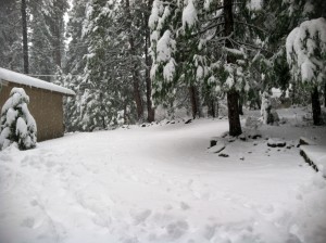
See “Conditions / Storm Activity” for weather maps and cam pictures. > > >
URGENT - WINTER WEATHER MESSAGE NATIONAL WEATHER SERVICE SACRAMENTO CA 305 PM PDT TUE MAR 13 2012 ...MULTIPLE STORM SYSTEMS WILL AFFECT THE AREA THIS WEEK... .A SERIES OF STORMS WILL IMPACT INTERIOR NORTHERN CALIFORNIA INTO THE WEEKEND. THE FIRST IS MOVING THROUGH AT THIS TIME BUT WILL STALL OVER THE AREA THEN WEAKEN WEDNESDAY. ADDITIONAL STORMS MOVE THROUGH THURSDAY INTO THE WEEKEND. SNOW LEVELS WILL RISE TO NEAR PASS LEVELS WEDNESDAY AND CONTINUE HIGH THROUGH EARLY FRIDAY THEN LOWER INTO THE FOOTHILLS FRIDAY NIGHT INTO SATURDAY. SIGNIFICANT SNOW IS EXPECTED IN THE HIGHER ELEVATIONS OF WESTERN PLUMAS MOUNTAINS AND SIERRA NEVADA THROUGH SUNDAY. CAZ069-141200- /O.EXT.KSTO.WS.W.0005.000000T0000Z-120314T1800Z/ WEST SLOPE NORTHERN SIERRA NEVADA- INCLUDING THE CITY OF...BLUE CANYON 305 PM PDT TUE MAR 13 2012 ...WINTER STORM WARNING NOW IN EFFECT UNTIL 11 AM PDT WEDNESDAY... * SNOW ACCUMULATIONS: 6 TO 12 INCHES ABOVE 5000 FEET WITH 1 TO 3 FEET POSSIBLE ABOVE 7000 FEET. * ELEVATIONS: ABOVE 5000 FEET. MOST SIGNIFICANT AMOUNTS ABOVE 6500 FEET. * TIMING: SNOW WILL CONTINUE TONIGHT INTO WEDNESDAY. * WINDS: SOUTH TO SOUTHWEST WINDS 20 TO 40 MPH WITH GUSTS UP TO 75 MPH OR HIGHER OVER EXPOSED HIGHER ELEVATION RIDGES. * IMPACTS: HAZARDOUS DRIVING CONDITIONS POSSIBLE DUE TO SNOW AND BLOWING SNOW CREATING POOR VISIBILITIES. DIFFICULT BACK COUNTRY TRAVELING CONDITIONS. TRAVEL DELAYS LIKELY. PRECAUTIONARY/PREPAREDNESS ACTIONS... A WINTER STORM WARNING MEANS SIGNIFICANT AMOUNTS OF SNOW ARE EXPECTED OR OCCURRING. STRONG WINDS ARE ALSO POSSIBLE. THIS WILL MAKE TRAVEL VERY HAZARDOUS OR IMPOSSIBLE.
Please take the appropriate steps to protect your property and community by removing dead or dying timber (whether standing or not), clearing your lot(s) appropriately of needles, slash, and other potentially flammable debris. There are a number of trees in Lilac Park infected with the Bark Beetle and these should be removed to reduce fire loading and to prevent spreading these pests to healthy trees.
See CalFire’s Lot Clearance Guidelines for appropriate clearances and other things you can do to protect your property. Start early, doing a little bit over a longer period of time helps make it an easier task. If you are unable to do this yourself, consider hiring a lot clearing service. Preliminary CalFire inspections have already begun.
Water Conservation
The lack of rainfall and snow in the Sierras this winter will also have an impact on water storage that comes from the many lakes, streams, and rivers in our area. Proper water conservation practices are crucial to preventing heavy restrictions on use of water and most are relatively simple and inexpensive to put into use around your Lilac Park home.
Here are just a few tips to help conserve:
Here’s 100 tips you can use around your home and business to help conserve water.
From the National Weather Service:
HAZARDOUS WEATHER OUTLOOK NATIONAL WEATHER SERVICE SACRAMENTO CA 354 AM PST TUE FEB 28 2012 CAZ013>019-063-064-066>069-291500- SHASTA LAKE AREA/NORTHERN SHASTA COUNTY- BURNEY BASIN/EASTERN SHASTA COUNTY-NORTHERN SACRAMENTO VALLEY- CENTRAL SACRAMENTO VALLEY-SOUTHERN SACRAMENTO VALLEY- CARQUINEZ STRAIT AND DELTA-NORTHERN SAN JOAQUIN VALLEY- MOUNTAINS SOUTHWESTERN SHASTA TO NORTHERN LAKE COUNTIES- CLEAR LAKE/SOUTHERN LAKE COUNTY-MOTHERLODE- EAST FOOTHILLS/NORTH SACRAMENTO VALLEY- WESTERN PLUMAS COUNTY/LASSEN PARK-WEST SLOPE NORTHERN SIERRA NEVADA- 354 AM PST TUE FEB 28 2012 THIS HAZARDOUS WEATHER OUTLOOK IS FOR INTERIOR NORTHERN CALIFORNIA. .DAY ONE...TODAY A STRONG WINTER STORM WILL BEGIN TO AFFECT THE INTERIOR OF NORTHERN CALIFORNIA TONIGHT BRINGING STRONG WINDS TO THE ENTIRE REGION ALONG WITH RAIN TO THE VALLEYS AND PERIODS OF HEAVY SNOW TO THE FOOTHILLS AND MOUNTAINS. * WINTER STORM WARNING.......SEE WWUS46 KSTO - WSWSTO FOR DETAILS * * WIND ADVISORY..............SEE WWUS76 KSTO - NPWSTO FOR DETAILS * .DAYS TWO THROUGH SEVEN... WEDNESDAY THROUGH MONDAY HEAVY SNOW WILL CONTINUE OVER THE MOUNTAINS WEDNESDAY WHILE THE CENTRAL VALLEY WILL SEE SHOWERS. WINDS WILL BEGIN TO DECREASE IN THE AFTERNOON. ACCUMULATING SNOW WILL CONTINUE OVER THE NORTHERN MOUNTAINS AND NORTHERN SIERRA NEVADA WEDNESDAY NIGHT AND THURSDAY. DRIER WEATHER IS EXPECTED TO RETURN FRIDAY AND OVER THE WEEKEND. * WINTER STORM WARNING.......SEE WWUS46 KSTO - WSWSTO FOR DETAILS * * WIND ADVISORY..............SEE WWUS76 KSTO - NPWSTO FOR DETAILS * .SPOTTER INFORMATION STATEMENT... WEATHER SPOTTERS ARE ENCOURAGED TO REPORT SIGNIFICANT WEATHER CONDITIONS TO THEIR LOCAL NATIONAL WEATHER SERVICE OFFICE. THE LATEST WEATHER INFORMATION IS AVAILABLE ON THE INTERNET AT (LOWER CASE): HTTP://WWW.WRH.NOAA.GOV/STO
If you’re traveling this weekend up into Arnold and the Sierras, please be prepared. Check conditions before you leave. Road conditions are available via the link to the right.
Check the “Storm Activity” page to the right for weather forecasts and other useful information.
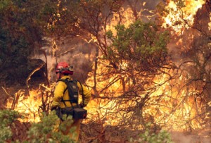
Starting 08:00 AM on Friday, January 13, 2012, the Toulumne-Calaveras Unit (TCU) of the California Department of Forestry and Fire Prevention (CAL FIRE) Will suspend outdoor burning within State Responsibility Areas of Tuolumne County, Calaveras County, Eastern Stanislaus County and Eastern San Joaquin County.
The Mother Lode is experiencing one of the driest winters on record. This lack of precipitation, combined with dry winds, has created fire danger levels similar to those usually seen during mid-summer. These conditions have contributed to an unusual number of wildfires caused by escaped debris burns. To minimize this danger to life and property, CAL FIRE will suspend all burning in the Tuolumne-Calaveras Unit until the area receives significant wetting rains.
“We recognize people conduct their defensible space clearance during the winter, and dispose of the debris by burning.” states Unit Chief Brian Kirk of the Tuolumne-Calaveras Unit. “But we are encouraging the public to help with this unseasonable wildfire danger by not doing any outdoor burning until we get significant wetting rains. Also, check old debris burn piles to ensure they are completely out. Deep piles of ashes retain heat for several weeks, and high winds can blow these hot ashes into nearby dry leaves or grass and start fires.”
CAL FIRE reminds everyone that it is their individual responsibility to use fire safely and to prevent fires that destroy lives, property and our wildland.
The wind in the mountains has subsided considerably in the last 12 hours, though it is still breezy. Some Lilac Park homes suffered minor damage from falling trees, but as of this posting, there have been no reports of injuries and property damage as been relatively minor.
PLEASE NOTE: Lilac Drive between Maple and Alder is still closed while clean up and utility crews remove debris and make repairs to downed power lines. If you’re headed into the Arnold area today or tomorrow and you have to travel this section of road, we strongly encourage that you plan your travels to arrive while there is still daylight. There are debris and branches everywhere and getting through this area on foot may be hazardous in low light conditions.
UTILITY STATUS:
Certain parts of Lilac Park continue to be without power (See areas in posts below). Comcast is down along the ridge section of Summit View, but how much of Lilac Park that’s affected is unclear at this point.
PROPERTY DAMAGE REPORTS:
The Fu family on Lilac Drive had a tree come down on their property resulting in fairly minor damage to the corner of their house and a portion of the surrounding deck. They have already been contacted.
There is a home on Ponderosa that sustained minor damage to a deck by a falling tree. The address and lot information isn’t available as of this posting, but Grace Neurath is attempting to make direct contact with the homeowner this morning.
There is a vacant home for sale on Summit View that sustained minor damage from a falling tree. We will attempt to contact the Real Estate office listing the property this morning.
CLEAN UP BEGINS
The entire area is littered with debris and branches and clean up efforts have already begun. If you’re planning a trip to assess your property and begin clean up, please be sure to bring appropriate tools. Lot cleaning services are also available HERE.
Going outside has been hazardous due to flying branches and other material so most are staying inside. The high winds have scattered debris over the entire area.
The downed power pole is located between Maple and Alder and is affecting homes in that area since 10:30pm last night. PG & E is on scene and actively working to correct the problem.
All of Laurel Circle is currently without power since 6:30am this morning. This outage may be related to the utility crew working on the downed pole, though this is unclear.
PG & E is aware of the problem.
The Pond family on Lilac Drive had a tree fall on their property resulting in severe damage to an automobile. Initial reports indicate that it was totalled.
There are two homes at the top end of Summit View that are without power due to a tree down, but this is isolated. The rest of Summit View and Ponderosa are currrently unaffected. No other reports of power status are available.
As of this update at 1:35pm, 12/1/11
NO DAMAGE TO STRUCTURES HAS BEEN REPORTED.
We’ll keep you updated.
POWER OUTAGES
Certain parts of Lilac Park are without power and have been since last night. PG & E reports numerous trees down all over the Arnold area with at least one utility pole down in Lilac Park affecting power and cable services to an unknown number of homes.
The PG & E map on our Storm Activity Page is a literal pincushion of power failures all over the central part of the state.
NATIONAL WEATHER SERVICE HAZARDOUS WEATHER OUTLOOK
.DAY ONE...TODAY WINDY CONDITIONS CONTINUE TODAY. NORTHERLY VALLEY WINDS 15 TO 40 WITH GUSTS UP TO 50 MPH ARE EXPECTED. WINDS IN THE MOUNTAINS WILL BE VERY WINDY TONIGHT INTO FRIDAY MORNING. NORTHEAST WINDS INCREASING TO 35 TO 50 MPH WITH GUSTS TO 80 MPH. GUSTS UP TO 100 MPH ARE POSSIBLE OVER HIGHEST RIDGES. NORTHEAST WINDS 25 TO 45 MPH WITH GUSTS TO 60 MPH AT ELEVATIONS BETWEEN 3000 AND 5000 FEET.